

Democrats More Likely To Believe False Information About Climate Change, New Survey Finds
When it comes to emissions, deaths, and costs of natural disasters, Democrats are more likely to believe misinformation than Republicans and Independents


For decades, social scientists have documented how Republicans are more skeptical of climate science than Democrats. A Pew Research Center survey in 2020 found that 72% of Democrats say human activity contributes a great deal to climate change where just 22% of Republicans do.
But a new Google survey of 1,500 Americans finds that Democrats are more likely than Republicans to believe false information about basic aspects of climate science. Environmental Progress, the independent nonprofit research organization for which I work, paid for the survey, and has made the results of the survey publicly viewable.
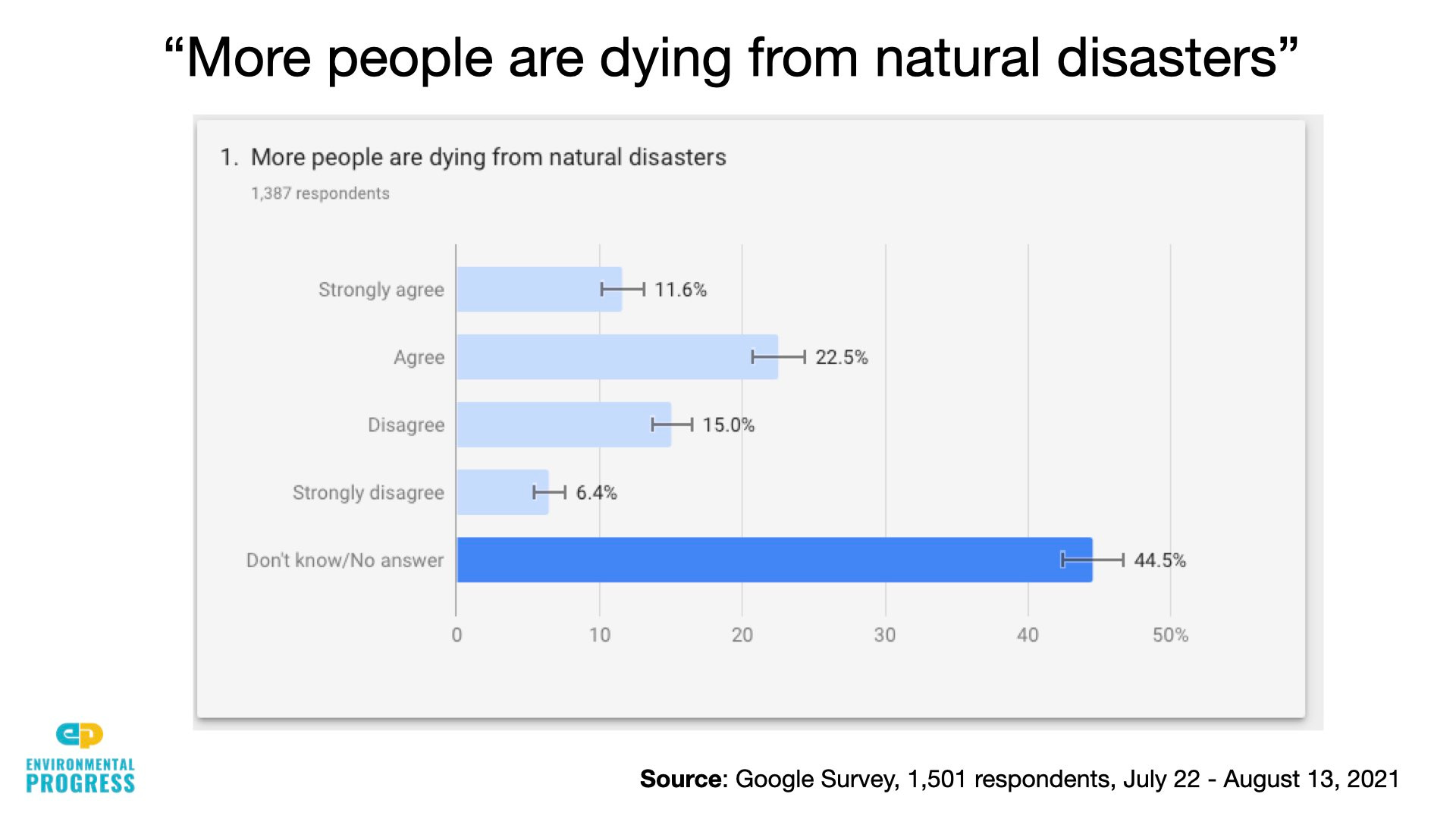
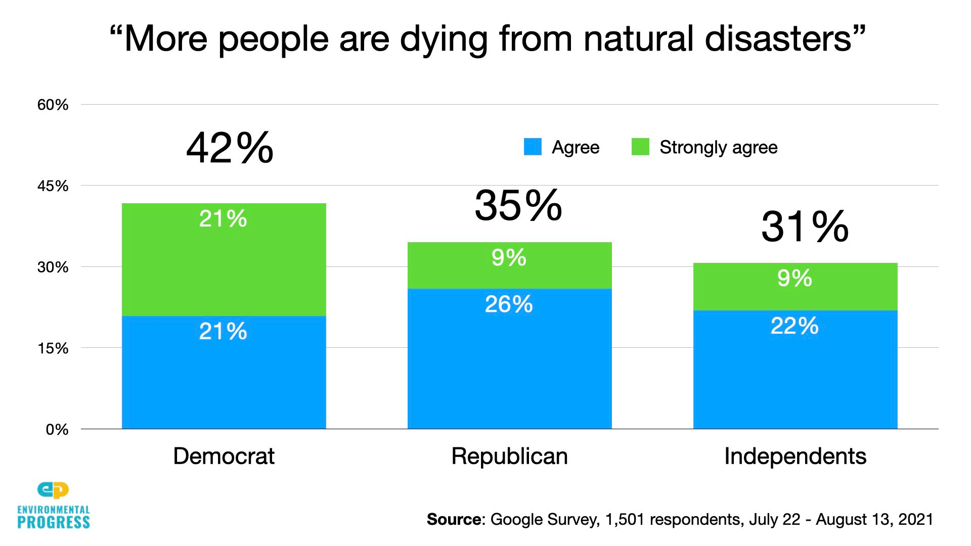
Forty-two percent of Democrats and 35 percent of Republicans agreed with the statement, “More people are dying from natural disasters.”
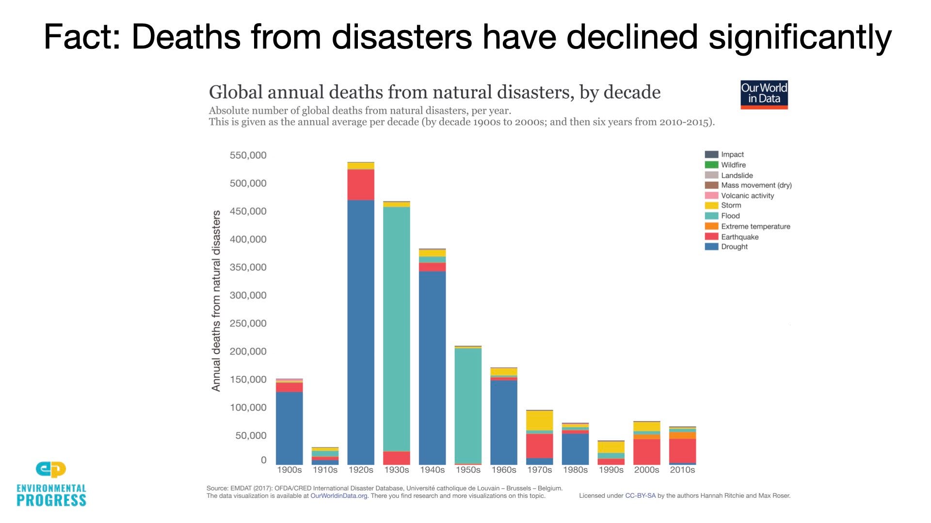
In reality, deaths from disasters have declined more than 90 percent worldwide over the last century, and by over 99 percent in other countries including Bangladesh over the last 40. Deaths declined in the U.S. from 413 to 320 between 2019 and 2020.
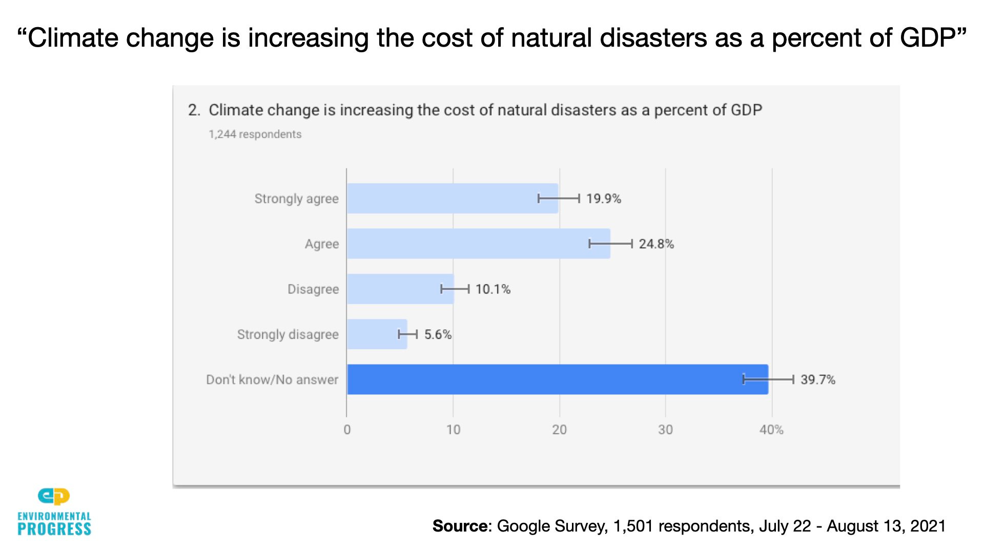
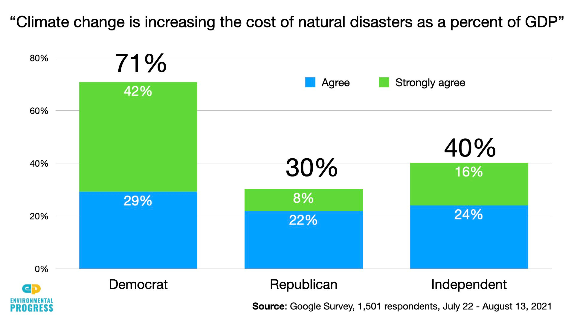
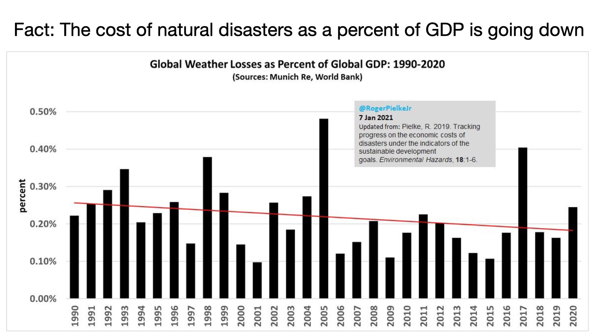
Seventy-one percent of Democrats and 30 percent of Republicans agreed with the statement, “Climate change is increasing the cost of natural disasters as a percent of GDP.”
In reality, the share of GDP spent on natural disasters has either declined or remained flat when “normalized,” meaning when scientists take into account increased wealth in harm’s way. Think of the higher cost of a hurricane in Miami Beach today than in 1921, when there were so few buildings on it.
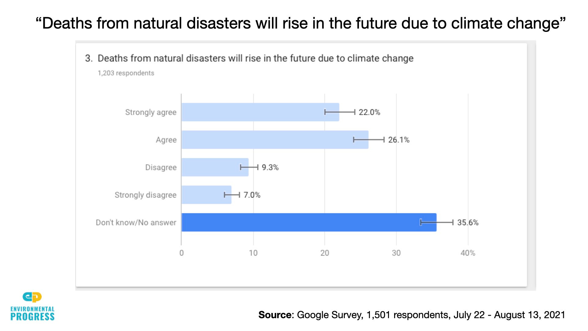
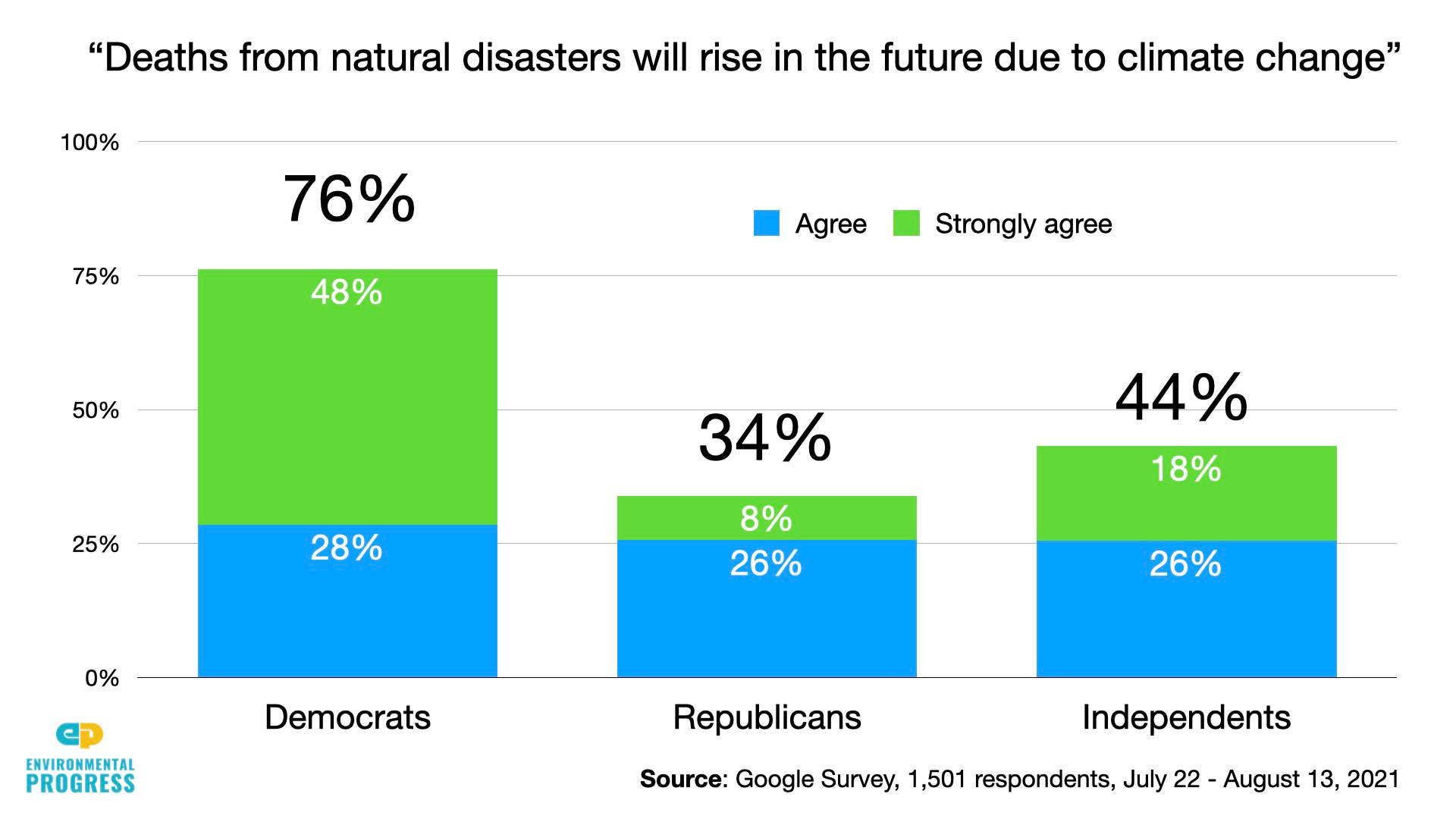
And 76 percent of Democrats and 34 percent of Republicans agreed that “Deaths from natural disasters will rise in the future due to climate change.”
In reality, neither the United Nations Intergovernmental Panel on Climate Change (IPCC) nor any other reputable scientific body predicts a reversal in the long-term trend of declining deaths, even under high degrees of warming.
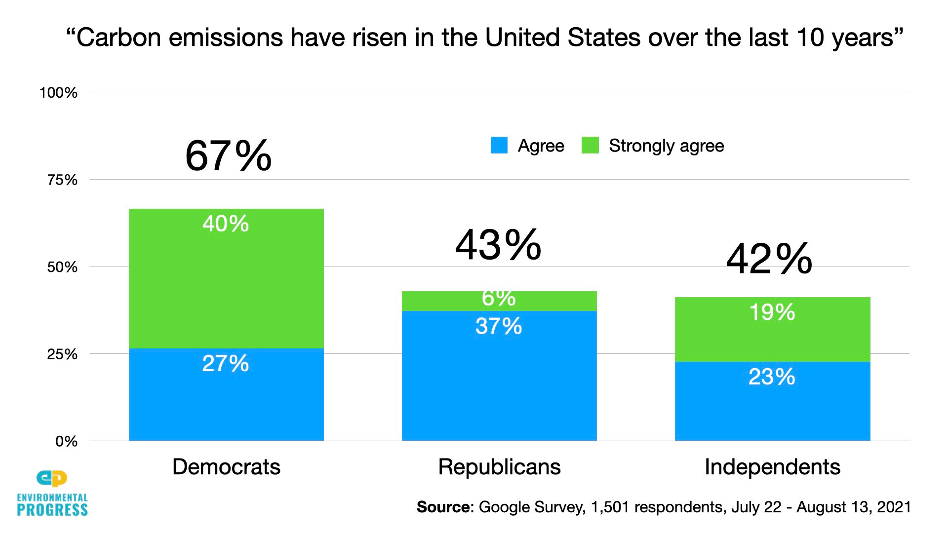
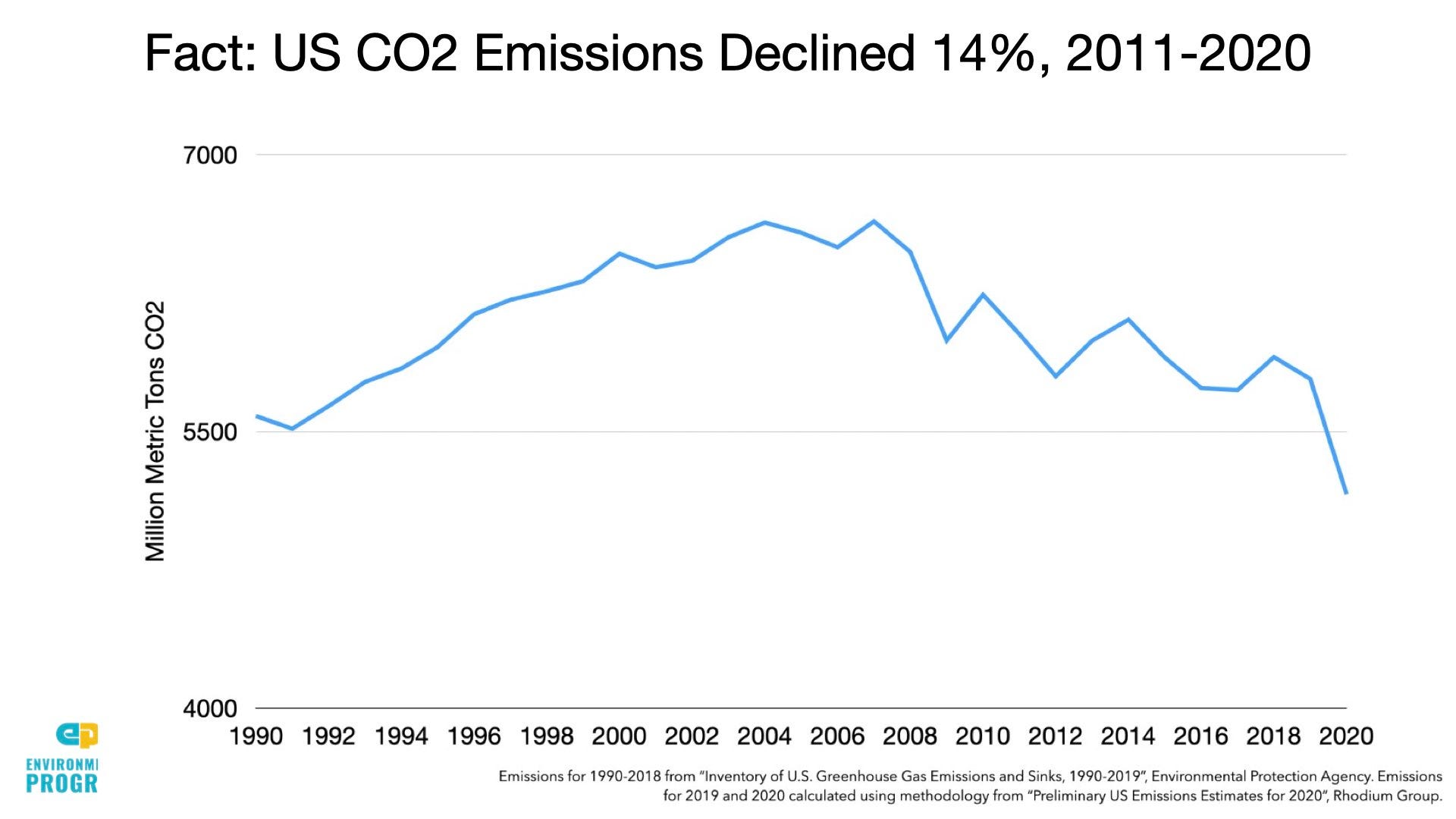
Finally, 67 percent of Democrats and 43 percent of Republicans agreed that “Carbon emissions have risen in the United States over the last 10 years.” In reality, carbon emissions declined by 14 percent between 2011 and 2020.
Google Surveys are based on a random representative sample of the population and are considered scientific. Cambridge University Press in 2017 published a study in which researchers replicated “four canonical social scientific experiments and one study of treatment heterogeneity” and concluded that Google Surveys “can be used effectively to achieve balance across treatment groups.”

I read some study on deforestation that used machine learning to measure forest area from satellite photos instead of self reported data from some UN committee. Basically, forest area has increased since satellite photography has been available in the 80’s.
Really great survey. The results are interesting.
It reminded me of “Factfulness” whereby people assume the world is in worse shape than it really is. On climate, it would seem that this is even more true for Democrats than Republicans.